The Atlantic hurricane season’s first tropical storm, Alberto, is expected to form over the Gulf of Mexico today, according to the National Hurricane Center. The disturbance has an 80% chance of becoming a tropical storm.
Forecasters predict heavy rains, coastal flooding, and gusty winds along the Texas and northeastern Mexico coasts through Thursday. Alberto is likely to reach the Mexican coast late Wednesday or early Thursday, currently moving at about 8 miles per hour. Early rains have already started in Texas, with potential impacts on the I-35 highway.
A Tropical Storm Warning is in effect for the Texas coast from the San Luis Pass to the Rio Grande’s mouth and the northeastern Mexican coast from the Rio Grande mouth to Puerto de Altamira.
Rainfall could reach 5 to 10 inches across northeast Mexico into southern Texas, with maximum totals of 15 inches, leading to significant flash and urban flooding, as well as new and renewed river flooding. Mudslides are also possible in areas of higher terrain across northeast Mexico. A storm surge of up to four feet might affect parts of the Texas coast.
The National Weather Service reported decreased overall rain totals on Wednesday morning, with most areas expected to receive between 1 to 3 inches of rain. However, local flooding of 4 inches or more remains possible, and a flood watch is in effect until Thursday.
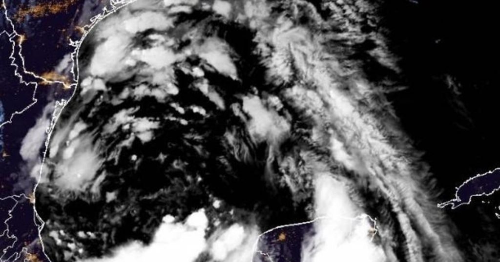
The disturbance was quite large early Wednesday, with tropical-storm-force winds extending up to 415 miles north of the system’s center. As of 4 a.m. CDT, the center was approximately 315 miles southeast of Brownsville, Texas, moving west-northwest at 8 mph with maximum sustained winds of 40 mph.
The hurricane center upgraded the season’s first tropical storm watch to a tropical storm warning at 4 a.m. CT on Tuesday. The Mexican government issued a tropical storm warning for the northeastern coast, replacing the previously effective tropical storm watch.
The difference lies in timing, with a “watch” indicating possible tropical storm conditions within roughly 48 hours, and a “warning” signaling more imminent conditions, about 36 hours away.
The Atlantic hurricane season officially started on June 1 and lasts through November, with most storm activity typically occurring between mid-August and mid-October.
The terms hurricane and tropical cyclone refer to the same kind of storm, with meteorologists using tropical cyclone as a broad classification for rotating, low-level cloud systems and thunderstorms developing over tropical or subtropical waters.
A tropical cyclone becomes a tropical storm when its maximum wind speeds exceed 39 mph and a hurricane when sustained winds reach 74 mph or higher.
")
")
![The wind whips up embers as the Palisades fire burns during a windstorm on the west side of Los Angeles, California [Ringo Chiu/Reuters]](https://esbecgroup.com/wp-content/uploads/2025/01/Hollywood-stars-lose-homes-as-out-of-control-wildfires-engulf-Los-Angeles.jpg)