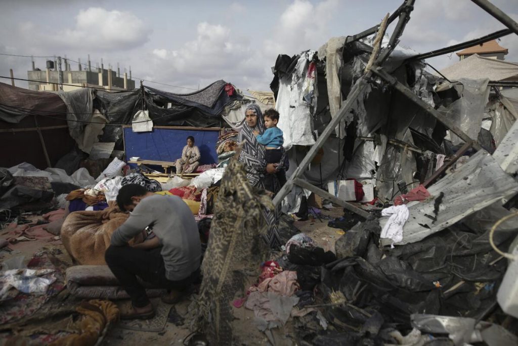
On May 26th, an Israeli airstrike devastated the Tel al Sultan neighborhood in Rafah, resulting in at least 45 fatalities. The attack ignited structures in a region housing displaced Palestinians, as reported by the Hamas-run health ministry in Gaza.
The strike’s epicenter was mere meters from the United Nations Relief and Works Agency’s compound in northern Rafah. Geolocated footage and satellite imagery confirm the destruction of buildings adjacent to a sign marking Kuwaiti Al-Salam Camp 1, a known haven for Palestinians displaced by the conflict.
Sky News meticulously verified numerous videos and photographs to reconstruct the aftermath. Distinctive features in the footage allowed for precise location identification and nighttime footage confirmation. The verified footage reveals numerous bodies extracted from the rubble, including a heartrending scene of a man carrying a decapitated child.
Satellite imagery from Planet Labs PBC on May 27th shows four buildings obliterated in the strike. A senior Israeli military official asserted on May 28th that the civilian deaths were collateral damage from an operation to eliminate two Hamas leaders. Rear Admiral Daniel Hagari stated that two 17kg munitions were used, with the ensuing fire causing much of the destruction, currently under investigation.
Footage from Palestinian journalist Alamuddin Sadiq at the strike site suggests the use of a GBU-39 Small Diameter Bomb (SDB). Weapons specialist Rahul Udoshi and former British army artillery officer Chris Cobb-Smith concurred, describing the munition as “advanced” and “state-of-the-art.” According to the Sipri Arms Transfers Database, Israel received 1,000 of these munitions from the US in 2023, following an accelerated delivery post the Hamas attack on October 7th.
Rear Admiral Hagari’s statement included aerial footage of the strike, pinpointing the targeted buildings. He asserted that aerial surveillance was employed to minimize civilian casualties. However, Sky News identified four individuals in the targeted building’s vicinity seconds before the strike.
Israel’s ground offensive in Rafah was preceded by a map delineating an evacuation area and a humanitarian zone. The targeted area lies between these two zones, in the neighborhood numbered 2372 by the Israeli government.


![Tom Homan, President-elect Donald Trump's appointee for '''''''''''''''''''''''''''''''border czar', speaks before a visit by Trump during the AmericaFest 2024 conference sponsored by conservative group Turning Point USA in Phoenix, Arizona, December 22, 2024 [Cheney Orr/Reuters]](https://esbecgroup.com/wp-content/uploads/2025/01/Trump-admin-to-launch-immigration-raids-on-day-one-amid-deportation-push.jpg)


